


i-Boating:Marine Navigation
4.12.19K Reviews
App Specs
- Version
- 291.0
- Updated On
- License
- Free
- Downloads
- 1,000,000+
- Developer
- Gps Nautical Charts
- Categories
- Travel & Local
- Platform
- Android
Screenshots
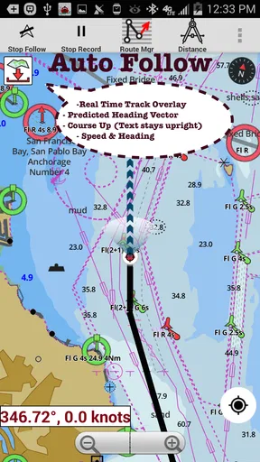
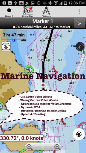
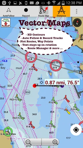
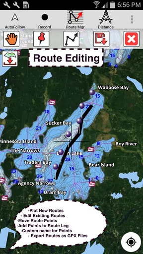
 Analysis by AppCompare
When I plan a day on the water, I want more than a moving dot on a blank screen. I want to understand the shape of the lake or coast, think through a route before leaving, and have useful information available when phone service becomes unreliable. That is the appeal of i-Boating: Marine Navigation: it brings chart-based navigation, fishing-oriented depth maps and marine weather into one travel app. I see it as a planning aid and a useful companion on board, not a substitute for sound judgment or proper safety equipment.
Setting Sail with i-Boating
First things first, getting started with i-Boating is as smooth as a gentle sea breeze. The app is available on both Android and iOS, so no matter your device preference, you’re all set to embark on your nautical adventures. Upon downloading, you’re greeted with an intuitive interface that even a landlubber could navigate.
The app is free to install, and its age rating is Everyone. It is made by Gps Nautical Charts, has been available since August 29, 2015, and its current version is 276.0, with Android 5.0 as the minimum requirement. I take those details as useful context, but what matters more in practice is whether the charts you need are available for your area and whether you prepare them before setting out. Optional in-app purchases range from $9.99 to $64.99 per item, so I would check the coverage and purchase details for a particular destination rather than assume every chart is included.
The app has an average rating of 4.2 from around 13,000 ratings, with about 2,100 written reviews, and has been installed over a million times. That gives a sense of its established audience, though ratings cannot tell me whether a specific lake, harbor, or stretch of coast is covered in the way I need. I would treat local chart availability as the deciding factor before relying on it for a trip.
The app brings together chart-based navigation, lake depth maps for fishing, marine charts and weather information. That combination is most appealing when I want to switch between planning a route and examining the water around it, rather than juggling a general road map and a separate chart app. The practical value depends on the chart region and the information available there, so I make a habit of checking the destination in advance.
Charting the Course
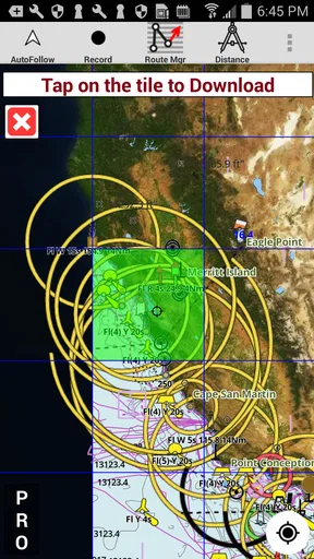
Let’s dive into what makes this app a standout. The offline charts are not just your run-of-the-mill maps; these are highly detailed, providing depth contours, tides, currents, and even fishing spots. It’s like having a seasoned sailor whispering secrets of the sea into your ear. And the best part? You can download these charts and access them anytime, without needing an internet connection. Talk about being prepared!
For a realistic weekend routine, I would open the chart at home, check the route and likely stopping areas, then make sure the relevant chart is downloaded before leaving. At the launch ramp, I can review the same chart without making a weak mobile signal part of the plan. Offline access is especially useful on lakes and remote shorelines, but it is not a reason to skip preparation: a phone battery can run down, and a chart app should sit alongside a charged device, a backup navigation method and ordinary boating safety practices.
Worth Reading Before You Choose

EA SPORTS FC Mobile 26 Is a Bigger Football Game, but It Takes Time

Flipboard Shows What News Apps Must Do Beyond the Feed

Switching to Android Auto Means Rethinking Your Driving Routine

Google Calendar Makes a Crowded Week Easier to Manage

Ludo King Makes the Most of the Minutes Between Plans

Baby Panda World Brings Quick Play to Modern Phones, but Its Game Library Feels Busy
Another nifty feature is the route planning. Plotting your course is as easy as dragging and dropping waypoints on your chart. The app calculates the distance and estimated time of arrival, which is super handy for planning those sunset cruises or early morning fishing trips.
I find route planning more useful when I treat it as a pre-trip check rather than a promise that the journey will follow the screen exactly. A route can help me compare a direct crossing with a more cautious path around a shoreline, and waypoints give a trip a clear structure. Before departing, I would review the whole route at a broader zoom and then inspect the areas where shallow water, turns or narrow passages could matter. Estimated arrival time is a planning aid, not a guarantee: actual progress depends on conditions, boat handling and decisions made on the water.
Weathering the Storm
No sailor likes surprises when it comes to the weather, and this is where i-Boating truly shines. The app provides real-time weather updates, including wind speed and direction. It’s like having your personal meteorologist on board, ensuring you’re never caught off guard by an unexpected squall.
I would use the weather view as one input in a decision, not as permission to go out. Checking wind direction can help me think about whether a route or exposed stretch is comfortable for the boat and people aboard, while checking again before departure is more sensible than relying on an old glance at home. Conditions can change, and no app can remove the need to use local judgment or follow official safety guidance.
If you’re anything like me, the safety features might just be the most comforting aspect. The app offers an anchor alarm, alerting you if your boat starts drifting. It’s like having an extra pair of eyes, keeping watch even when you’re not.
An anchor alarm is most useful when I set it deliberately after anchoring, then confirm that the alert is active and the phone can be heard or noticed. It can provide reassurance while I am aboard, but I would not treat it as a watchkeeper or assume it can prevent an incident. The practical habit is to use it as a secondary check, keep an eye on the surroundings and consider what could interfere with noticing an alert.
Anchoring Down with Ease
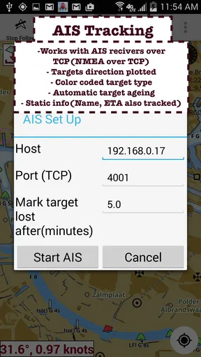
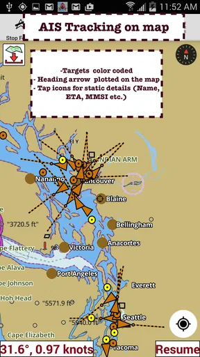
One of the highlights of i-Boating is its user-friendly design. The developers have really thought of everything. The app supports seamless integration with AIS and GPS, making it compatible with most marine electronics. Plus, it’s constantly updated to ensure you have the latest chart data at your fingertips.
In day-to-day use, I would keep the workflow simple: choose the destination, inspect the chart, make a route, and check weather before departure. That repeatable order reduces the chance of discovering at the dock that a chart still needs attention. I would also check the app’s settings and device setup before a trip, especially anything affecting chart downloads, location access, display readability or alerts. Those are practical checks rather than claims about special hidden controls; the exact options can depend on the device and app version.
For faster planning, I would save routes and tracks after a trip when I know the record is useful, rather than trying to organize everything while underway. A familiar route can make a return outing easier to prepare, but I would still inspect it each time: water conditions, access and the day’s destination may call for changes. Similarly, sharing a track is convenient for passing along a route, but a saved line should not be mistaken for a guarantee that another boater can safely follow it under different conditions.
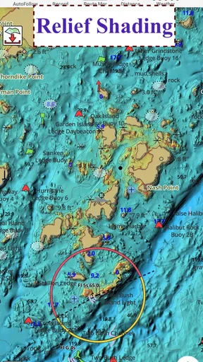
For fishing, the depth contours and fishing spots offer a different kind of value from ordinary turn-by-turn navigation. I can use the chart to understand the shape of an area and plan where to spend time, rather than simply heading to a pin. That is helpful for anglers who want navigation and water context together. Someone who only wants to find a restaurant or drive to a marina may find a conventional map app quicker and less specialized.
For a small-boat outing on a familiar lake, I would use the app to inspect depth information at home, mark a few useful route points, and download the chart before leaving. On the water, the chart can help orient me as I move between areas, while weather information gives me another reason to reassess the plan. This is a stronger fit than using it for a casual walk around town: its value appears when the trip depends on waterways, chart details and preparation.
Compared with a basic phone map, i-Boating is oriented around nautical charts and water-specific information rather than roads and nearby businesses. Compared with using separate tools for charts, weather and route notes, having these functions in one app may make trip preparation feel more connected. The trade-off is that a general map is often better for land-based errands, while dedicated marine equipment may suit boaters who need a larger, purpose-built display or rely on a complete onboard setup. I would choose according to the trip, not expect one phone app to replace every tool.
For a first-time user, the most useful question is not simply how to draw a route but whether the relevant chart area is ready for offline use. I would settle that before paying for anything, then check what the chosen chart or purchase covers. Another sensible question is whether the phone will remain usable in the conditions of the trip: battery life, screen visibility and safe handling matter just as much as the app’s map. These checks make the app more dependable without assuming that navigation software can solve every on-water problem.
The app is a good match for recreational boaters and anglers who want chart context, route planning and weather in one place, especially when connectivity may be patchy. It is less compelling if I only need road directions, prefer a dedicated chartplotter as my primary navigation system, or cannot find suitable coverage for the waters I visit. I would also avoid making it my sole safety resource. Its strongest role is as a prepared, accessible companion—not an excuse to stop checking conditions or carrying a backup plan.
For anyone wondering whether it is worth trying, the free installation makes it possible to explore the app, while optional purchases mean I would verify the local chart before committing to paid coverage. If the area and chart details suit my kind of boating, the mix of offline access, route planning, depth information and weather can earn a place in my routine. If the chart coverage does not match the destination, or a trip calls for specialized onboard equipment, another option is the better choice.
For those who love sharing their adventures, the app allows you to save and share your routes and tracks. Imagine reliving your glorious voyage through the Mediterranean or sharing your favorite fishing spots with your fellow sea dogs. It’s all possible with just a few taps.
Final Thoughts
In the end, i-Boating: Marine Navigation is more than just an app; it’s your trusty first mate, guiding you through the waters with confidence and ease. Whether you're a seasoned sailor or a weekend warrior, this app offers the tools and peace of mind you need to enjoy your time on the water.
So, next time you’re setting sail, be sure to have i-Boating by your side. With its comprehensive features and intuitive interface, you’ll be navigating like a pro in no time. Happy sailing!
Pros
- Detailed offline maps available.
- User-friendly interface for easy navigation.
- Supports multiple chart formats.
- Real-time weather updates included.
- Customizable waypoints and routes.
Cons
- Initial setup can be time-consuming.
- Some features require in-app purchases.
- Occasional GPS signal drops.
- Limited social sharing options.
- High battery consumption on continuous use.
FAQs for i-Boating:Marine Navigation
What features does i-Boating: Marine Navigation offer for boaters?
i-Boating: Marine Navigation provides detailed nautical charts and offline maps for seamless navigation. Users can benefit from route planning, automatic course correction, AIS integration, and tide predictions. The app also offers sonar charts, weather updates, and the ability to sync data across devices, making it a comprehensive tool for both novice and experienced boaters.
Is i-Boating suitable for offline use?
Yes, i-Boating is designed for offline use. Users can download nautical charts and maps to their devices, allowing for uninterrupted navigation even without an internet connection. This feature is particularly useful for areas with poor connectivity, ensuring that boaters have access to essential navigation data at all times.
How accurate are the charts and maps provided by i-Boating?
The charts and maps in i-Boating are highly accurate, sourced from official hydrographic offices and regularly updated. The app provides detailed information on marine routes, depths, and hazards. This accuracy ensures users can navigate safely and with confidence, whether they're on a leisurely cruise or tackling more challenging waters.
Can i-Boating be used for both recreational and commercial boating?
Yes, i-Boating caters to both recreational and commercial boating needs. Its extensive feature set, including AIS tracking, weather forecasts, and route planning, makes it suitable for a variety of maritime activities. Whether you're planning a fishing trip or managing a fleet, i-Boating offers tools to enhance your navigation experience.
What devices are compatible with i-Boating: Marine Navigation?
i-Boating is available for both Android and iOS devices, supporting a wide range of smartphones and tablets. The app is optimized for performance and ease of use, ensuring a smooth experience on most modern devices. Users should check their device's operating system compatibility before downloading to ensure full functionality.


